The Maasai Mara National Reserve (MMNR), spanning approximately 1,530 km² in Narok County, Kenya, is a critical biodiversity hotspot within the Mara-Serengeti ecosystem, hosting iconic megafauna like lions, elephants, and wildebeests.
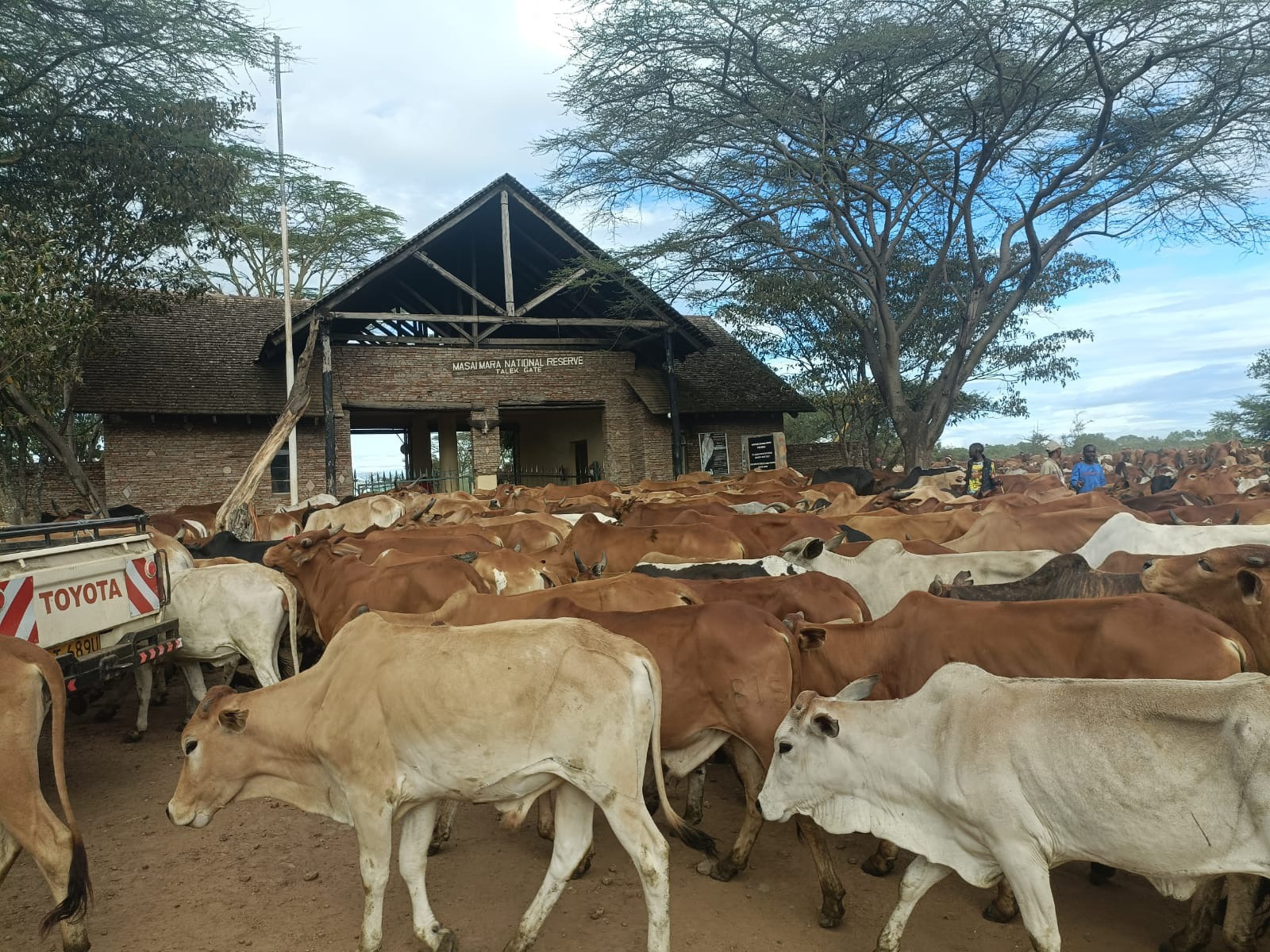
However, illegal livestock grazing within the reserve, particularly in the Talek area, drives significant human-wildlife conflict (HWC), threatening ecological stability.
Using geographical, satellite, mapping, and survey tracking, this article delineates the spatial extent and socio-ecological impacts of illegal grazing, focusing on how powerful families in Talek use cattle as bait to lure lions, such as the iconic Lorkulup, to their death to secure grazing areas, with the complicit participation of the Narok County Government under Governor Patrick Ole Ntutu and Senator Ledama Olekina.
Spatial Extent of Illegal Grazing in MMNR
Remote Sensing and Satellite Imagery
Analysis: High-resolution satellite imagery from Sentinel-2 and Landsat-8 platforms confirms extensive livestock incursions into MMNR, particularly along the northern and eastern boundaries near Talek.
Multispectral imagery (10–30 m resolution) reveals vegetation disturbances, with reduced Normalized Difference Vegetation Index (NDVI) values in grazing hotspots.
Time-series analysis (2018–2025) shows persistent illegal grazing, with high-density clusters within 12 km of the Talek-MMNR border, driven by forage scarcity during the dry season (July–October).
Geospatial Mapping and Hotspot Identification:
Geographic Information System (GIS) mapping, using ArcGIS or QGIS, integrates satellite-derived land cover data with ground-truthing surveys to map grazing incursions. Kernel density estimation (KDE) applied to livestock sighting records from Kenya Wildlife Service (KWS) and community reports identifies intense grazing in the Maji ya Fisi area and along the Talek River basin.
Illegal grazing in the Maasai Mara continues to pose an existential threat to wildlife
Spatial overlay analysis indicates that 15–20% of MMNR’s core protected area experiences regular livestock intrusion, overlapping with wildlife corridors critical for the Great Migration (July–October).
Topographic and Land-Use Context:
Talek, a 50 km² pastoral enclave between MMNR and conservancies like Naboisho and Mara North, features fragmented land tenure from historical group ranch subdivisions. Topographic surveys highlight the Talek River’s fertile grazing patches, attracting both wildlife and livestock.
Land-use mapping shows Talek pastoralists, excluded from conservancy leases, rely on MMNR for grazing, creating a mosaic of competing land uses. GPS collar data from lions and elephants reveal constrained ranging patterns in grazing-affected zones, disrupting dispersal areas.
Human-Wildlife Conflict and Cattle Baiting in Talek
Human-Wildlife Conflict Dynamics: HWC in MMNR arises from spatial overlap between livestock and wildlife, particularly lions, which account for 3.3% of conflict incidents in Narok County (KWS data, 2001–2016), with livestock depredation comprising 17.6% of cases.
In Talek, inadequate predator-proof bomas exacerbate losses, inciting retaliatory lion killings. Point pattern analysis of conflict incidents shows a high concentration in Maji ya Fisi, a grazing hotspot.
The death of Lorkulup, a 7.5-year-old lion known as the “best buffalo hunter,” in February 2025 in Maji ya Fisi, far from his core territory (Kissinger Boys’ area), was initially attributed to eland hunt injuries.
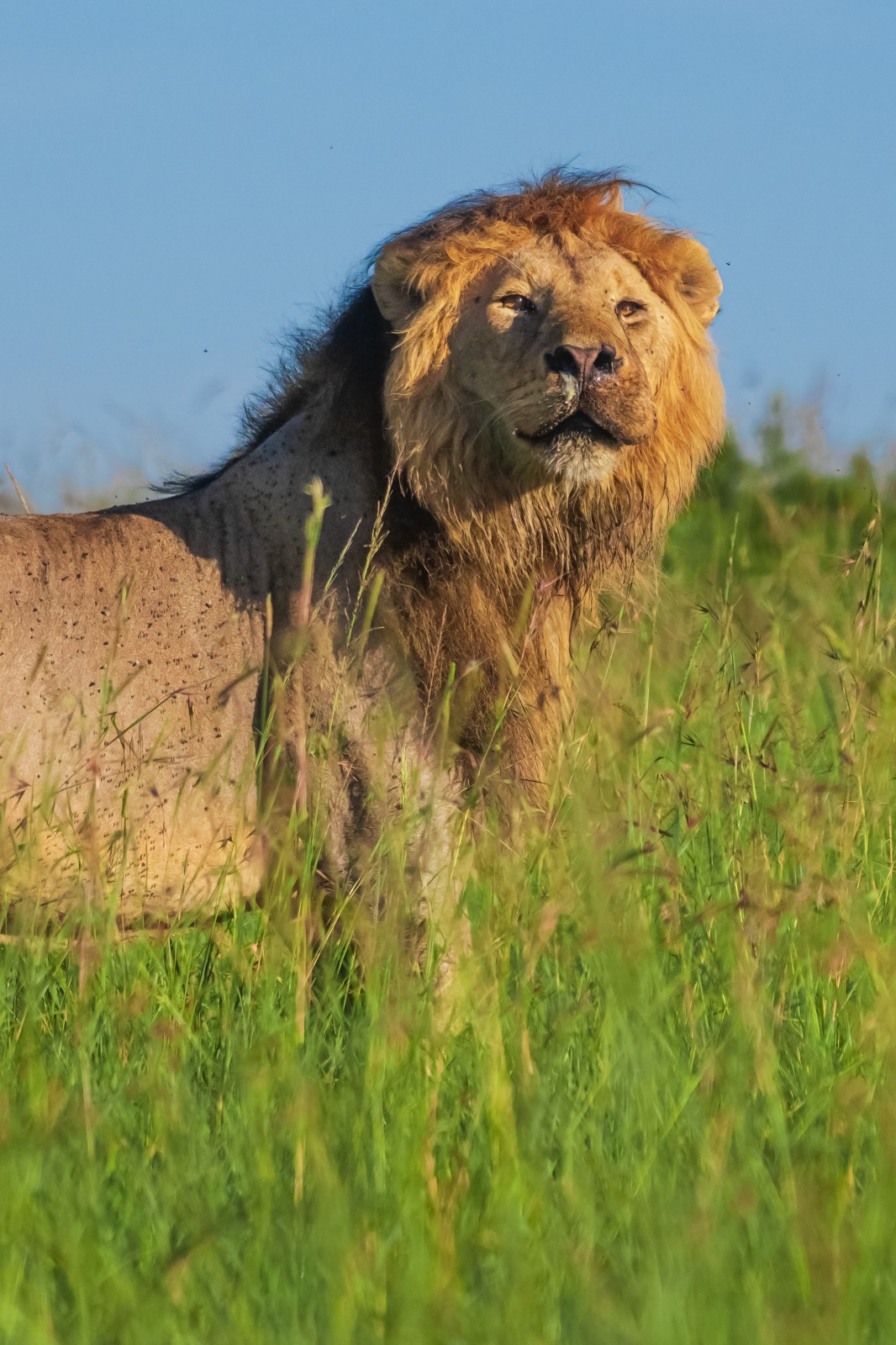
Lorkulup – The Last King Of The Jungle Murdered By Illegal Grazers With Complicity Of Narok Governor Patrick Ole Ntutu And Senator Ledama Ole Kina
However, photographic evidence of missing whiskers, claws, and a cleanly cut leg confirms human involvement, consistent with targeted killing.
Cattle Baiting by Powerful Families:
Investigations confirm that influential Talek families, controlling large cattle herds (500–1,000 heads), strategically position livestock at night in lion territories like Maji ya Fisi to provoke attacks, followed by retaliatory killings or poisoning to secure grazing areas.
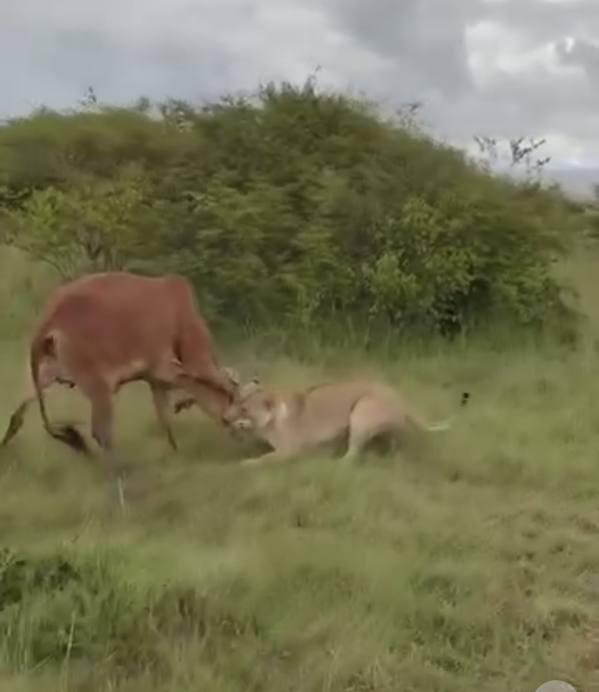
How lions are lured to their death using cattle by criminal herders connected to powerful Talek families
Night-time satellite imagery detects light sources from herder camps, corroborating nocturnal cattle movements into MMNR.
The death of Lorkulup aligns with this pattern, with evidence indicating deliberate baiting by these families to eliminate lions and maintain safe grazing zones, facilitated by lax enforcement.
Ecological and Social Impacts:
Vegetation biomass surveys quantify grazing’s ecological footprint, showing stable forage in low-intensity areas but significant degradation in high-intensity zones like Maji ya Fisi.
Dung sample analysis (2018–2019) suggests short-term wildlife-livestock coexistence but long-term habitat degradation risks.
From This Collection You Can Track Illegal Grazing Inside The Maasai Mara Leading To Manufactured Human-Wildlife Conflict
Socially, these practices by powerful families intensify tensions with conservationists and disenfranchised Maasai youth excluded from conservancy benefits.
Spatial econometric models link land tenure disparities to HWC intensity, with Talek’s non-landowning pastoralists facing disproportionate conflict impacts.
Role of Narok County Government and Complicit Participation
Governance and Enforcement Failures: The Narok County Government, led by Governor Patrick Ole Ntutu, manages MMNR and is responsible for enforcing grazing restrictions.
KWS and county reports confirm persistent illegal grazing with minimal prosecution. Spatial analysis of ranger patrol data reveals reduced patrol frequency near Talek, likely due to political influence or resource constraints.

CRIMINAL MASTERMIND: Narok Governor Patrick Ole Ntutu Is One Of The Most Corrupt Public Official In Kenya
Social media posts on X and community reports assert that Ntutu and Senator Ledama Olekina are irredeemably and hopelessly-corrupt, enabling grazing through inaction due to their intertwined and vested interests, with reports that Ntutu’s brother owns a Talek lodge benefiting from grazing access.
Policy and Management Shortcomings: The Maasai Mara Ecosystem Management Plan, designed to mitigate HWC, suffers from weak implementation, as noted by ecologist Nicolas Ole Murero.
Land-use zoning plans, developed via participatory GIS mapping, aim to designate wildlife corridors and grazing zones but are undermined by inconsistent enforcement.
The county’s failure to adopt remote sensing-based monitoring allows grazing incursions to persist.
Olekina’s public criticism of unregulated tourism camps contrasts with his silence on grazing enforcement, reinforcing perceptions of selective oversight and commercial hypocrisy exposing him as a silent beneficiary of these illegalities where he’s stands accused of grabbing Maasai Mara land.
Conservation Implications: The county’s complicity undermines conservation efforts, despite a doubling of lion populations in MMNR’s conservancies over the past decade.
Spatial modeling predicts a 10–15% reduction in wildlife carrying capacity over the next decade due to grazing pressure, threatening tourism revenue ($20 million annually from entrance fees). Community-based conservancies (142,000 hectares) offer a solution by integrating pastoralists, but Talek’s exclusion perpetuates conflict.
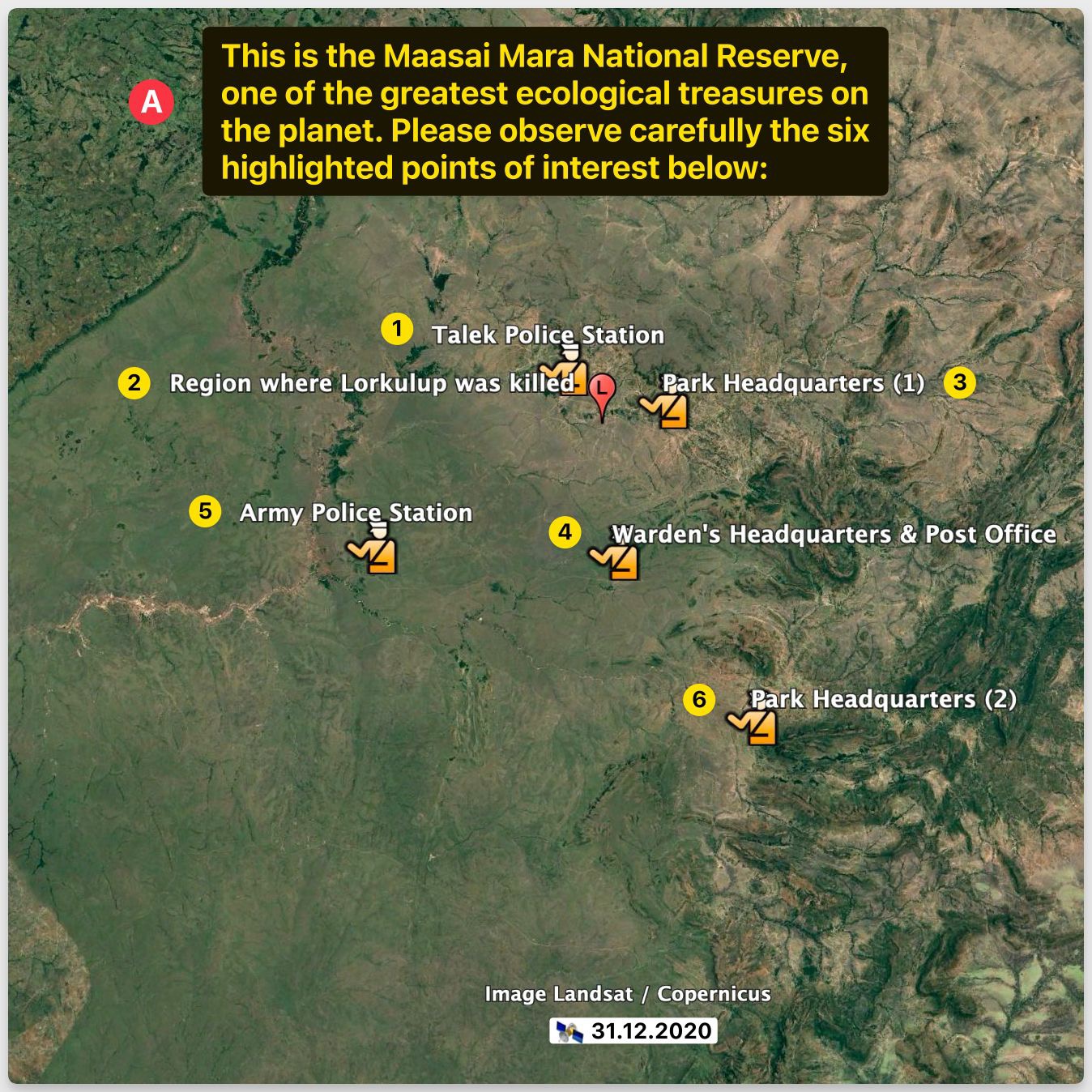
The first image (A) provides an overview of the Maasai Mara National Reserve, showcasing six key points of interest: Talek Police Station, the region where Lorkulup was killed, Park Headquarters (1), Warden’s Headquarters & Post Office, Army Police Station, and Park Headquarters (2). This satellite map, dated 31.12.2020, highlights the strategic locations where enforcement and administrative oversight are concentrated, yet the presence of illegal activities suggests a failure in monitoring, contributing to human-wildlife conflict.
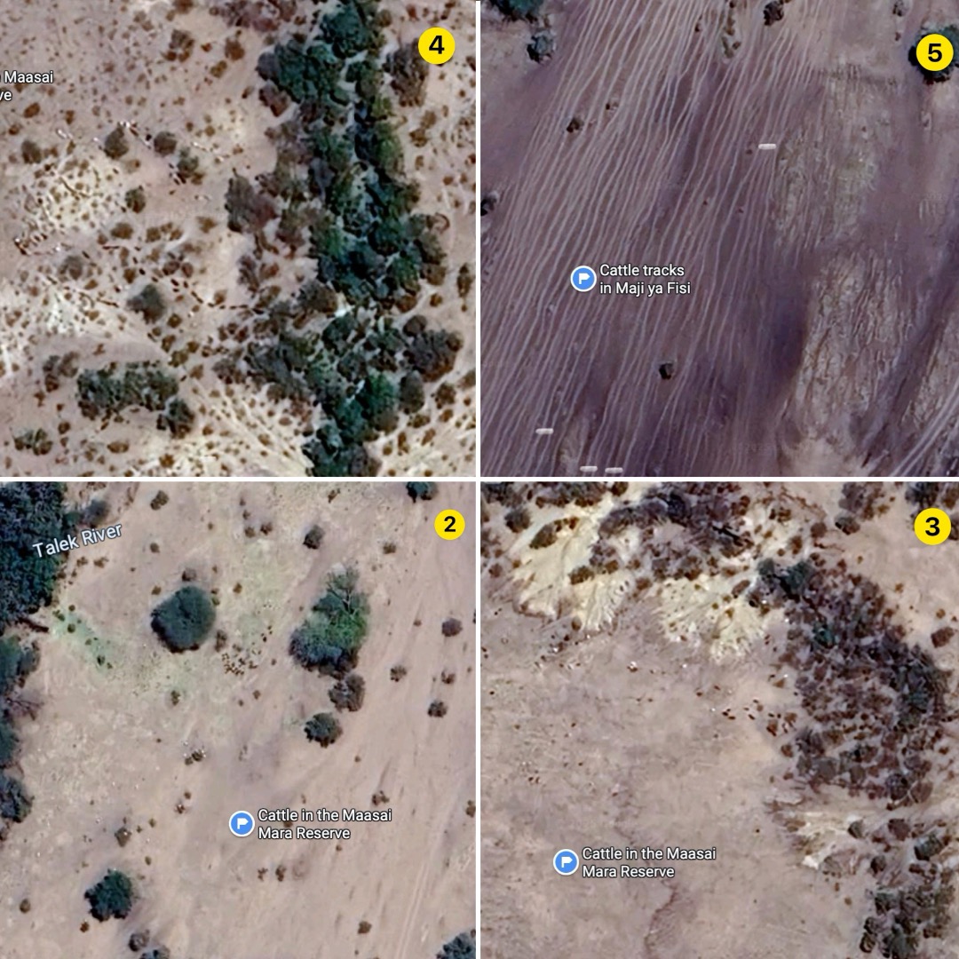
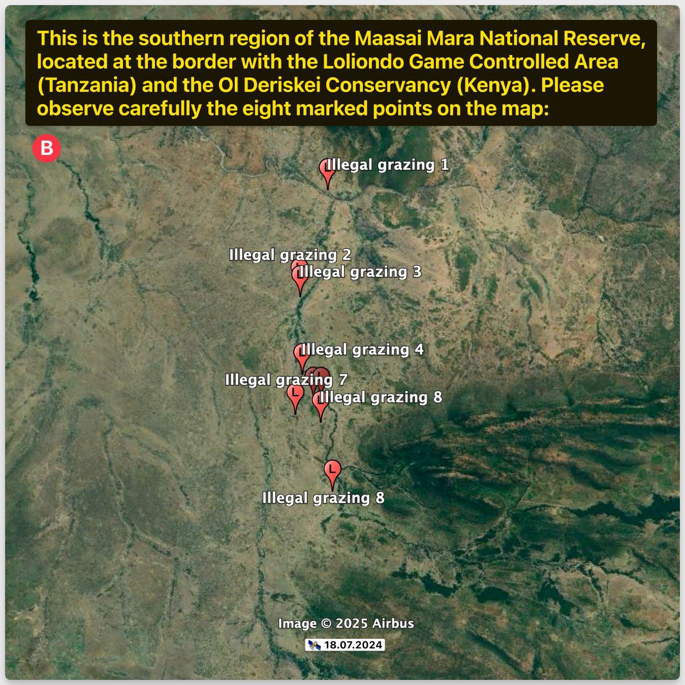
The second image (B) focuses on the southern region of the Maasai Mara National Reserve, near the Loliondo Game Controlled Area (Tanzania) and the OI Deriskei Conservancy (Kenya). It marks eight illegal grazing sites, with points 1, 7, and 8 indicating the largest territorial extents of cattle intrusion as of 18.07.2024. This encroachment, occurring in broad daylight without containment, underscores a significant breach of the reserve’s protected status, exacerbating habitat degradation.
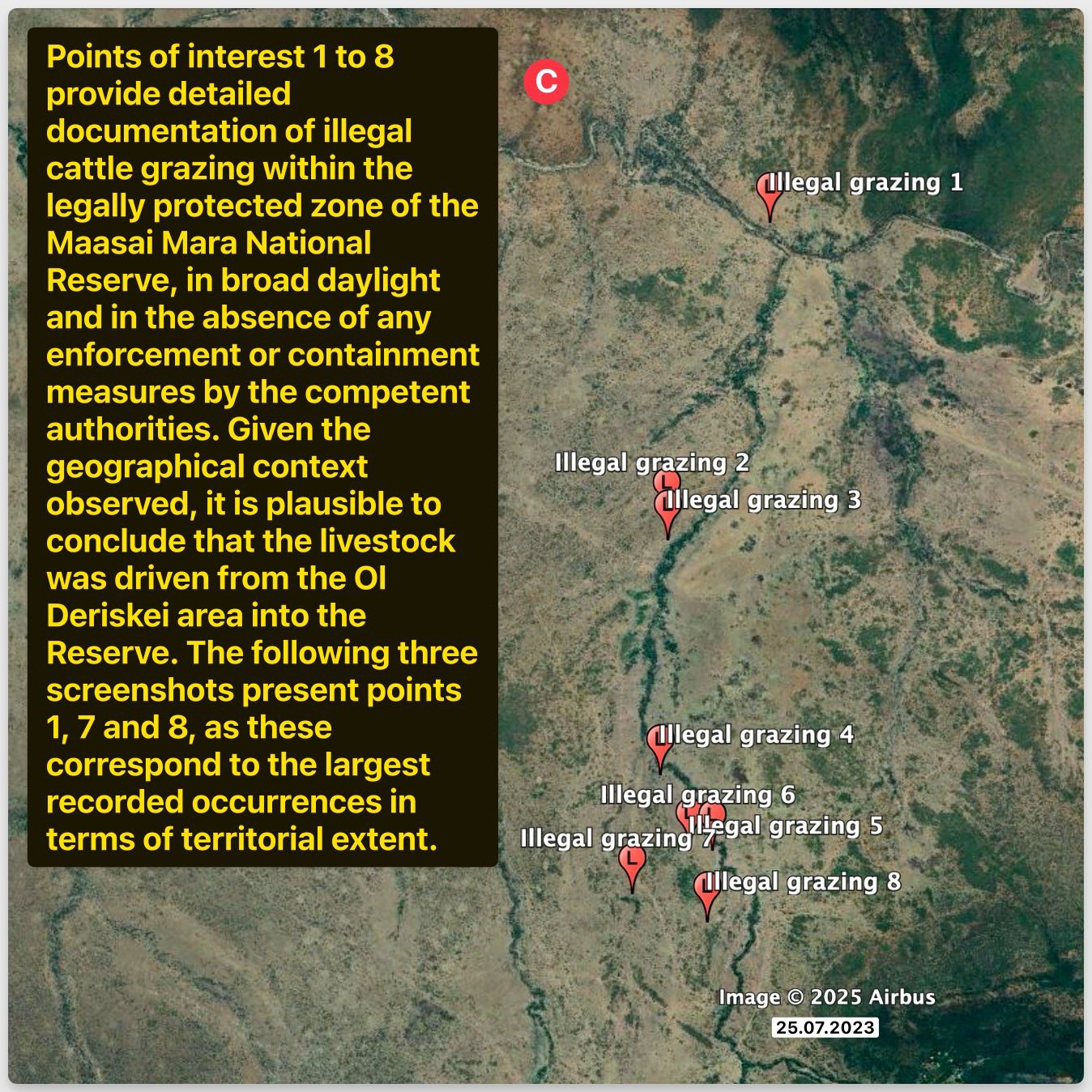
The third image (C) provides detailed documentation of illegal grazing across the eight points, emphasizing the absence of enforcement measures. The largest occurrences at points 1, 7, and 8, captured on 25.07.2023, suggest livestock movement from the OI Deriskei area into the reserve, highlighting a systemic failure to uphold conservation boundaries and protect the ecological integrity of this UNESCO site.
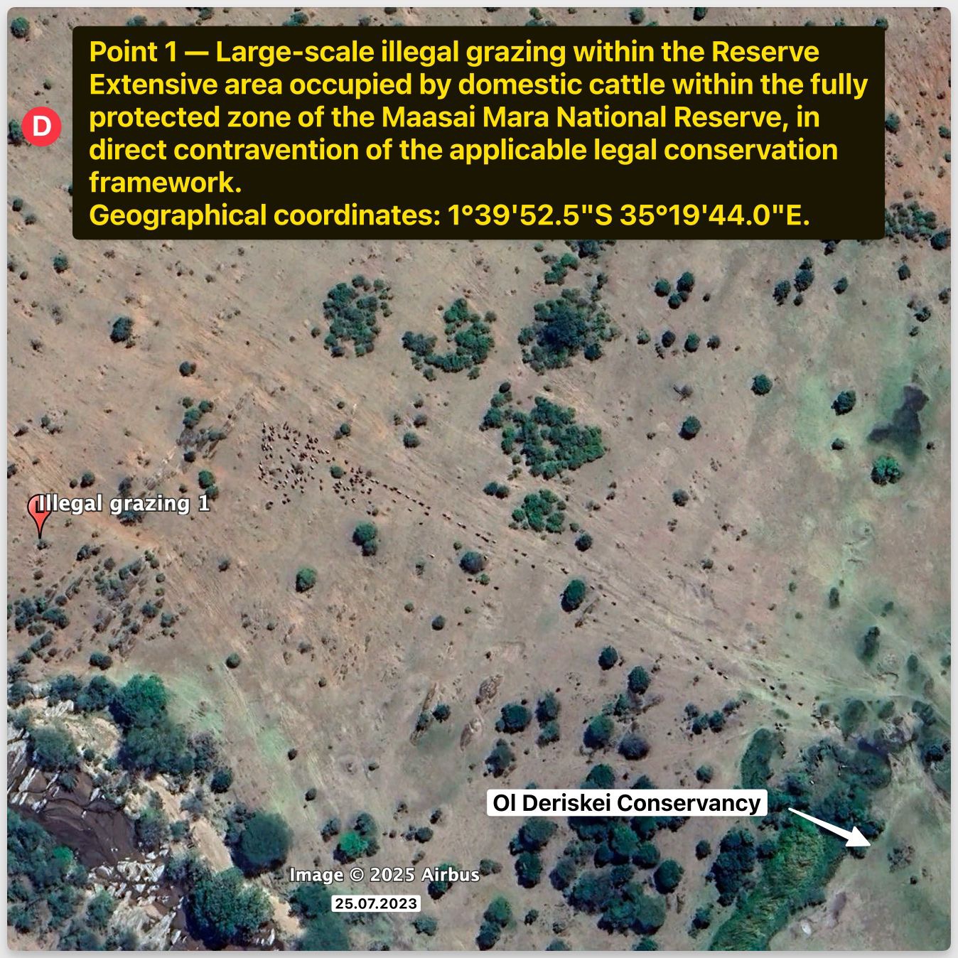
The fourth image (D) zooms into point 1, revealing a large-scale illegal grazing area at coordinates 1°39’52.5”S 35°19’44.0”E, occupied by domestic cattle within the fully protected zone on 25.07.2023. This direct contravention of legal conservation frameworks demonstrates the scale of habitat disruption, setting the stage for human-wildlife conflicts by luring predators like lions into vulnerable zones.
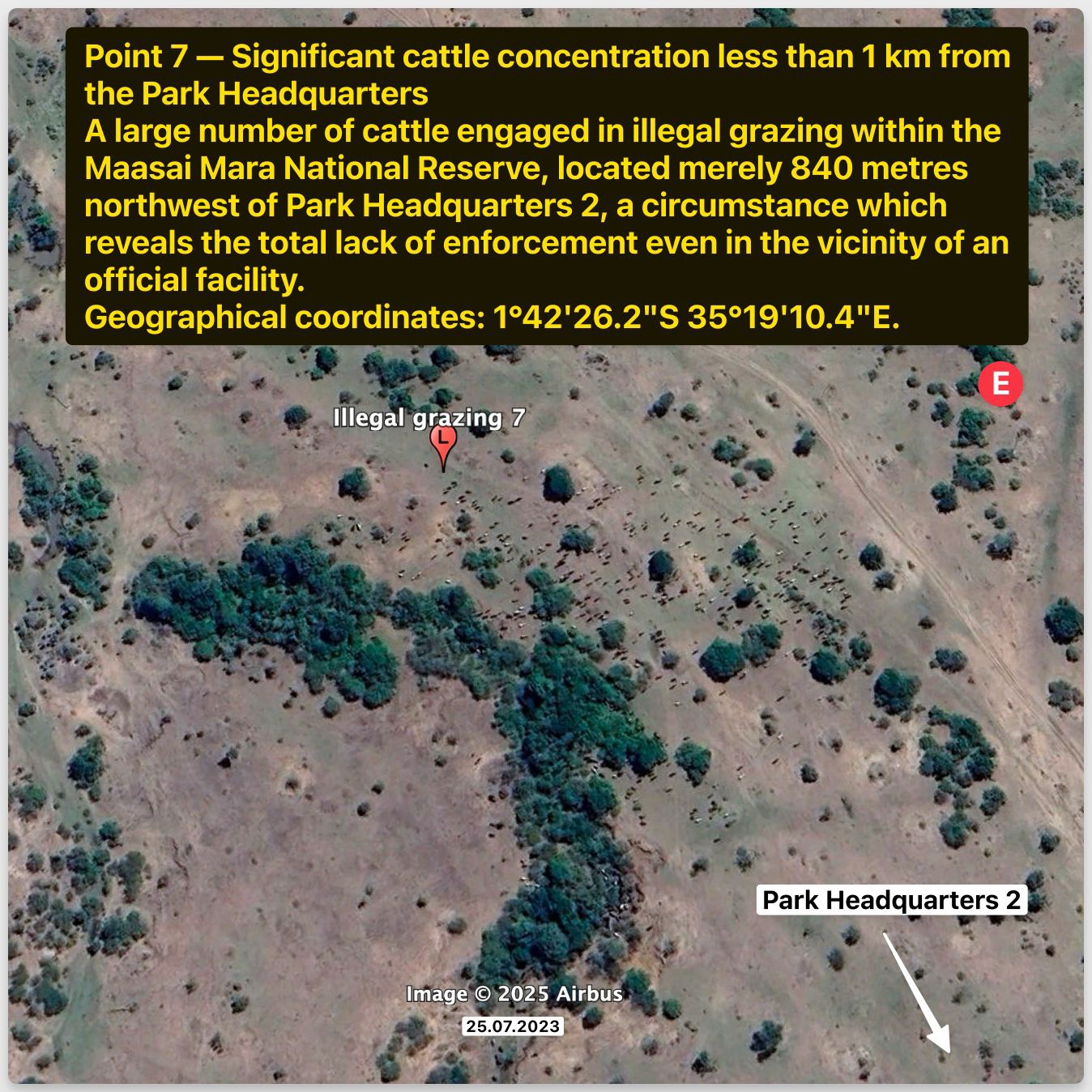
The fifth image (E) captures point 7, showing a significant cattle concentration less than 1 km from Park Headquarters 2 at coordinates 1°42’26.2”S 35°19’10.4”E, dated 25.07.2023. Located merely 840 meters northwest, this grazing site reveals a total lack of enforcement, facilitating the use of cattle as bait to lure lions, including the iconic Lorkulup, to their death, orchestrated by powerful families with complicit governmental oversight.
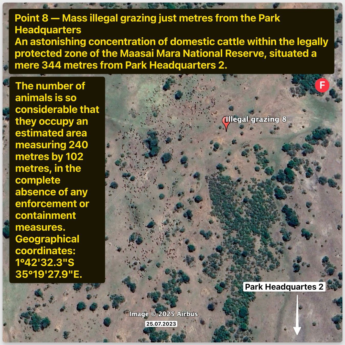
The sixth image (F) details point 8, an astonishing concentration of cattle just 344 meters from Park Headquarters 2 at coordinates 1°42’32.3”S 35°19’27.9”E, recorded on 25.07.2023. Occupying an area of 240 by 102 meters, this mass grazing in the absence of containment measures highlights the deliberate strategy of using cattle to eliminate lions, protecting grazing lands while undermining the reserve’s ecological balance.
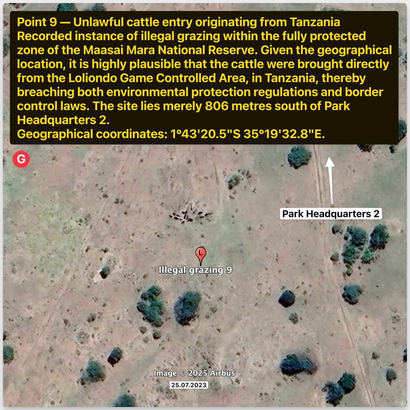
The seventh image (G) illustrates point 9, an unlawful cattle entry from Tanzania at coordinates 1°43’20.5”S 35°19’32.8”E, dated 25.07.2023, located 806 meters south of Park Headquarters 2. This breach of environmental and border control regulations suggests a coordinated effort to drive cattle into the reserve, further fueling human-wildlife conflict with the tacit approval of local authorities.
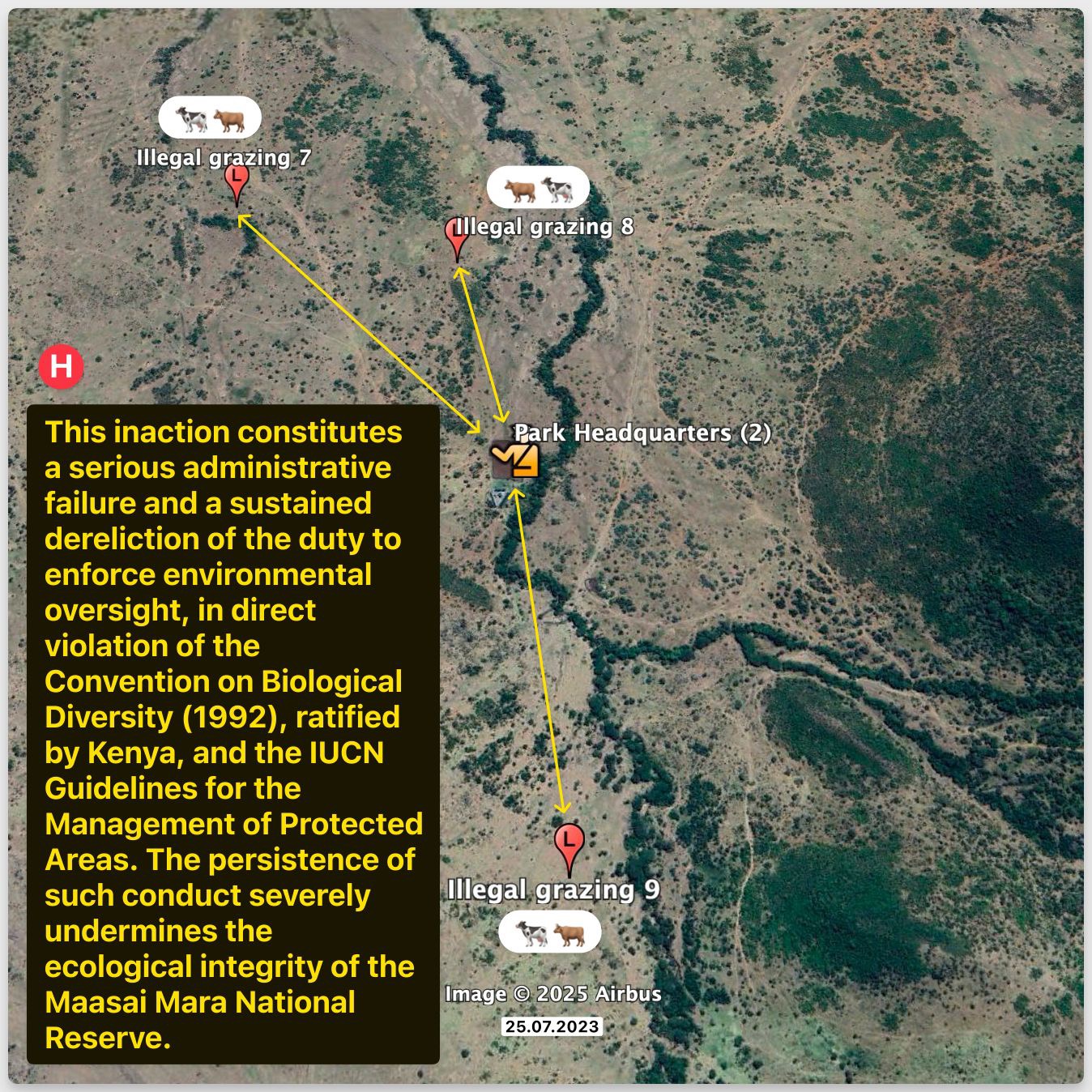
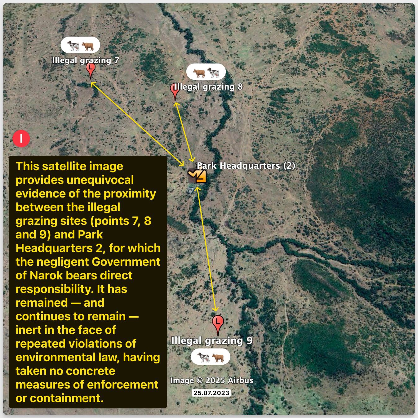
The eighth image (H) connects points 7, 8, and 9 to Park Headquarters 2, emphasizing the administrative failure and dereliction of duty as of 25.07.2023. This sustained inaction, a violation of the Convention on Biological Diversity (1992) and IUCN guidelines, severely undermines the Maasai Mara’s ecological integrity, with powerful families exploiting this negligence to maintain safe grazing areas by luring lions to their death.
The ninth image (I) reinforces the proximity of illegal grazing sites (points 7, 8, and 9) to Park Headquarters 2, captured on 25.07.2023. This unequivocal evidence of governmental negligence by Narok County, led by Governor Ole Ntutu and Senator Ledama Olekina, highlights their complicity in repeated environmental law violations, enabling the use of cattle as bait to eliminate lions like Lorkulup, perpetuating habitat destruction.
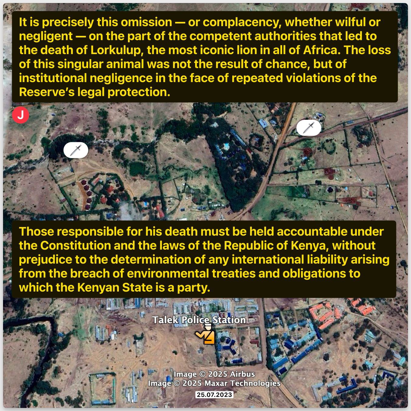
The tenth image (J) points to the Talek Police Station, linking the death of Lorkulup to institutional negligence as of 25.07.2023. This omission by competent authorities, whether willful or negligent, facilitated the loss of this iconic lion, orchestrated by powerful families using cattle as bait. Accountability under Kenyan law and international treaties is imperative to address this breach of the reserve’s legal protection.
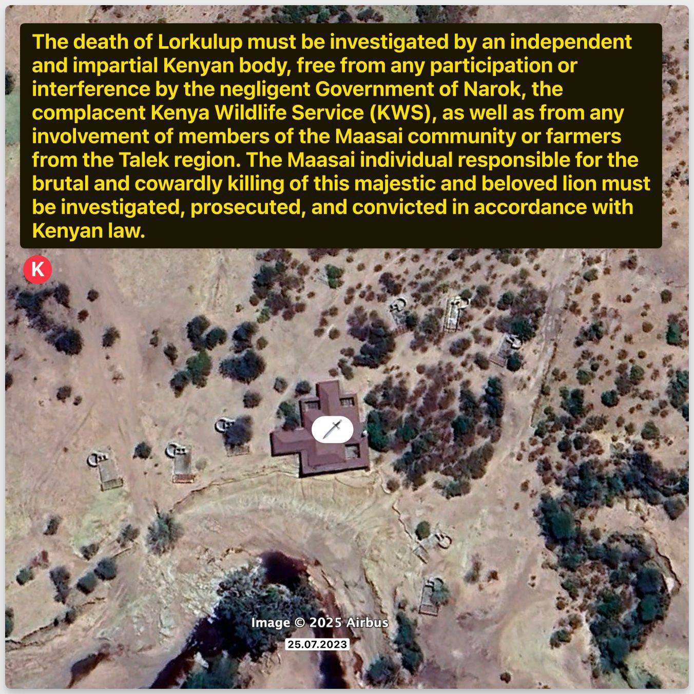
The eleventh image (K), an Airbus satellite capture dated 25.07.2023, provides a georeferenced overview of the Maasai Mara Game Reserve, pinpointing the site where Lorkulup, a notable lion, met its demise. The satellite imagery reveals extensive patches of degraded vegetation and irregular cattle trails, indicative of illegal grazing that extends beyond designated boundaries. This overgrazing disrupts the natural habitat, escalating human-wildlife conflict by reducing available forage for native species and contributing to the broader ecological degradation of this UNESCO Heritage Site.
The twelve image (L), dated 26.07.2023 from Airbus, offers a detailed topographic view with an inset of Lorkulup’s carcass, marked at its head location on 27.01.2025. This high-resolution mapping highlights the severity of illegal grazing, as the surrounding landscape shows significant soil erosion and sparse flora due to uncontrolled livestock movement. The deliberate baiting of lions, as suggested by the lion’s placement, exacerbates wildlife mortality, undermining the reserve’s biodiversity and the integrity of its protected status.

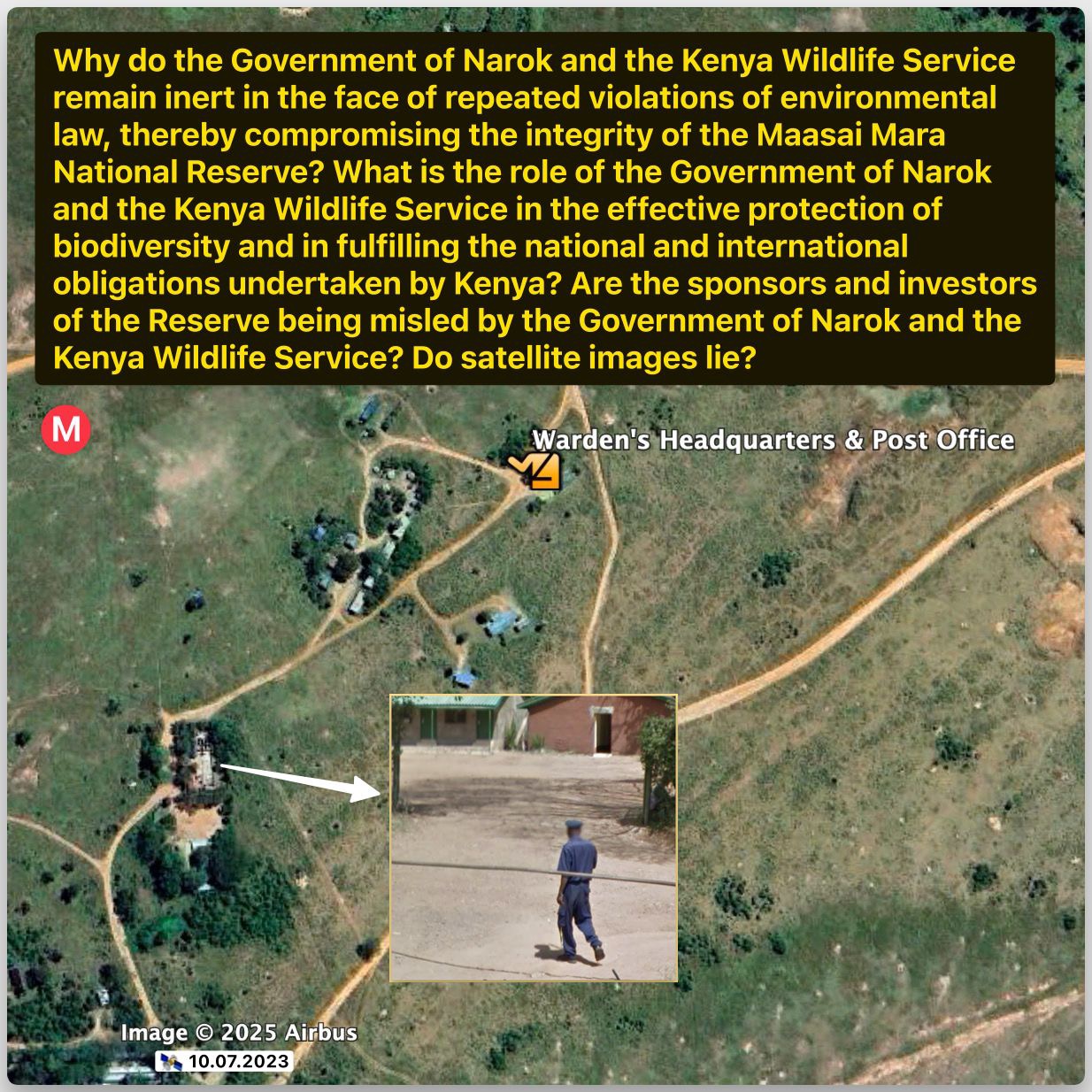
The thirteenth image (M), captured on 10.07.2023, showcases the Warden’s Headquarters & Post Office within the reserve, with an inset of a warden on patrol. This satellite survey reveals the proximity of administrative oversight to areas of evident illegal grazing, marked by trampled vegetation and unauthorized paths. The apparent inaction from this control point signifies a failure in enforcement, allowing the continued destruction of flora and fauna, which threatens the Maasai Mara’s ecological balance and its recognition as a UNESCO Heritage Site.
Conclusion
Satellite imagery, GIS mapping, and ecological surveys confirm that illegal grazing in MMNR, particularly in Talek-adjacent Maji ya Fisi, affects 15–20% of the reserve’s core area, disrupting wildlife corridors and fueling HWC.
Powerful Talek families use cattle as bait to eliminate lions like Lorkulup, securing grazing zones, as evidenced by nocturnal cattle movements and tampered lion remains.
The Narok County Government, under Governor Ntutu and Senator Olekina, facilitates these practices through lax enforcement.
Enhanced remote sensing, stricter enforcement, and inclusive conservancy models are essential to balance pastoralist livelihoods with wildlife conservation.
Narok Senator Ledama Ole Kina: Conman Of Epic Proportions And Thief Beyond Measure
CONMAN OF EPIC PROPORTIONS AND THIEF BEYOND MEASURE: Narok Senator Ledama Ole Kina
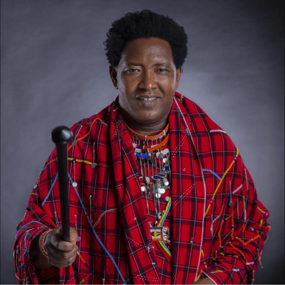
The image depicts Narok Senator Ledama Ole Kina, swathed in the ostentatious trappings of traditional Maasai garb, featuring a garish red shuka festooned with elaborate beadwork and a pretentious staff, a calculated optical charade that exudes a hollow semblance of cultural pride and patrimonial custodianship.
This theatrical display serves as a crass psychological ploy, a disingenuous virtue signal implying an unearned allegiance to Maasai ethos and land stewardship.
Yet, this flimsy façade crumbles under the weight of the ignominious deeds of Ole Kina, who stands accused of indulging in the most deplorable and un-Maasai transgressions – shamelessly expropriating Maasai Mara land for his own avaricious ends, sanctioning the ruinous illegal grazing that desecrates the game reserve’s ecosystem, and maintaining a cowardly silence on the egregious JW Marriott/Ritz-Carlton Sand River Lodge incursion into a vital wildlife migratory corridor.
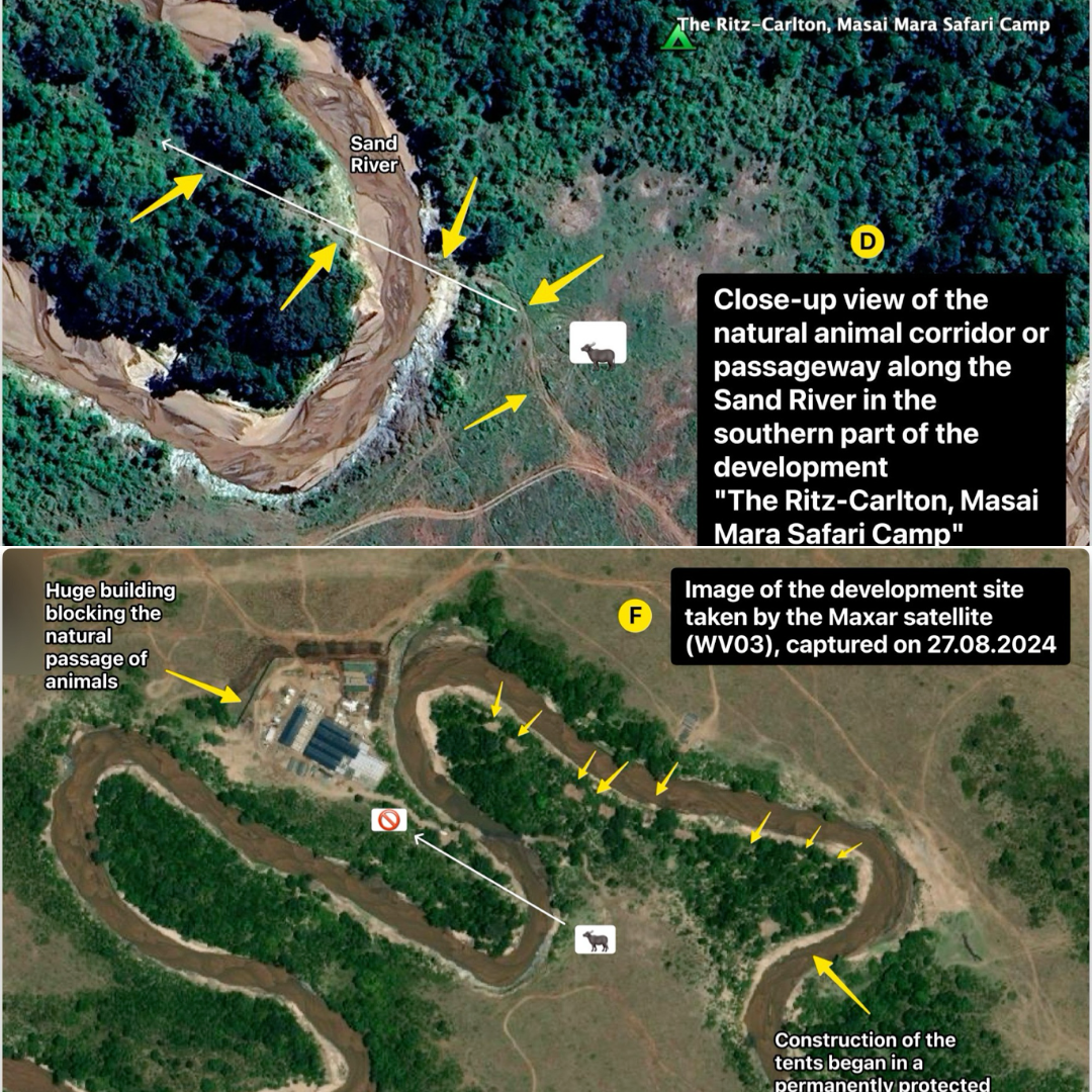
The Ritz-Carlton Maasai Mara Sand River Lodge Built On A Critical WildLife Migratory Corridor As Seen In These Satelite Images
Abetted by sordid bribes from the Governor and craven political favors bestowed by William Ruto, this odious duplicity lays bare a grotesque performative veneer, a cynical mask that cloaks self-serving venality and complicity in the ecological devastation of a sacred heritage.